L’archéologie des médias est un domaine de recherche d’une richesse incroyable et, en même temps, une sorte de discipline à laquelle on s’astreint, parfois malgré soi. Il y a quelques jours, j’ai remis la main sur un disque dur que j’avais perdu depuis la fin de mes études. Il contenait tous mes projets de recherche, aboutis ou avortés, universitaires ou personnels. Quelle ne fut pas ma joie, moi qui croyais que ces suites de mots numériques avaient été perdues à tout jamais, comme le fut les photographies de familles et les films que je réalisais, pour n’importe quelle raison, durant mon adolescence. Concernant cela, l’ensemble est définitivement perdu, à l’occasion d’un grand feu d’ordinateur. Quoi qu’il en soit, comme une renaissance, je redécouvrai toutes ces rédactions, tantôt impersonnelles, tantôt naïves ; celles qui se retrouvent d’ailleurs, à part égale, sur ce blog (sinon, à quoi servirait un blog ?).
Parmi elles figure une intervention réalisée en anglais. Il s’agissait d’une présentation du travail réalisé en master 2, dont la soutenance venait d’avoir lieu en septembre 2019. J’avais pu en parler dans l’un des premiers articles de ce blog, qui reprend l’intitulé : « Archives parisiennes de la Planète« , tiré de ce mémoire. Un mois plus tard, en octobre, j’ai eu la chance d’être invité au Colloque « Patrimoine culturel et humanités numériques » avec l’Université de Wǔhàn (武汉大学), nouveau partenaire de l’École nationale des chartes (法国国立宪章学院). Il s’agit plus précisément de l’École de gestion de l’information rattachée à cette Université (« School of Information Management »). L’anglais étant la langue servant de socle commun aux deux institutions, voici les intitulés : Cultural Heritage and Digital Humanities « 文化遗产与数字人文”论坛日程安排 » : A comparative approach through research projects. Programme PDF 1, PDF 2). Je tairai l’ironie de la situation et la triste célébrité dont la ville de Wǔhàn sera étoffée quelques mois plus tard. Par-delà ce concours de circonstances ayant engendré un ralentissement dans la mise en œuvre de ce partenariat, il n’en demeure pas moins que ce colloque fut très enrichissant. J’intervenai donc avec le titre le plus modeste, dans le champ des Digital Humanities studies, en tant que Graduate Student. Voici donc la trace écrite ainsi que les images ayant servi à mon intervention :
Albert Kahn’s Colourful Paris
Digital Exploitation of the Parisian
Archives of the Planet (1910–1937)
阿尔伯特・卡恩(Albert Kahn)的色彩缤纷的巴黎:对巴黎人档案的数字开发(1910- 1937年)
École nationale des chartes 法国国立宪章学院
I’m happy to be presenting you with my thesis work carried out through my Digital Humanities Masters École nationale des chartes. I was able to carry my research of a photographic fund through specific cartographic tools and database. This research is at the crossroads between Paris’ History, photography, visual studies and Geographical Information Systems (GIS).
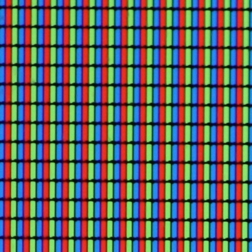
The Autochrome from potato starch to pixels
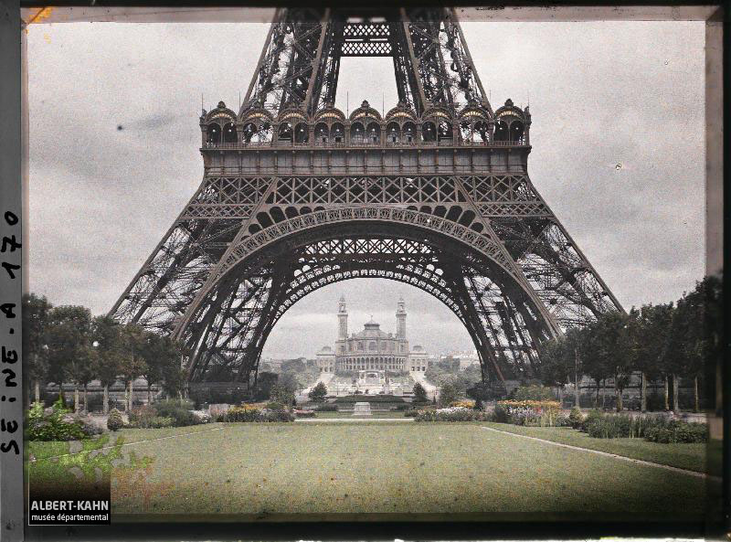
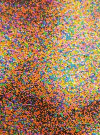
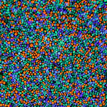
The work I carried made use of the “Archives of the planet” photographic fund, created in 1909, by banker and philanthropist Albert Kahn. In a bid to document life through the 1910s to the 1930s, Albert Kahn funded expeditions to fill the Archives of the planet with photographs and films. Consequently, 72 000 autochromes and over a hundred hours of film were collected across sixty countries. My research exclusively focused on autochromes. Patented by the Lumière brothers in 1903, this process was commodified in 1907 and enabled immediate photography on colourized glass plaques, of which you can see an example of on this slide.
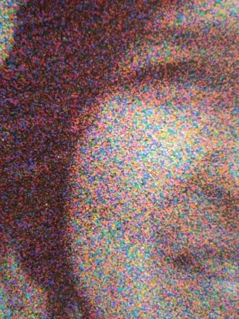
Whereas the photographic plate required a meticulous work of creation, inventory and diffusion, the digitization of the image multiplies the possibilities of treatment and research. At the time, these plaques could only be shown on rare occasions, especially during screenings organized by Albert Kahn in his very large house near Paris. We will come back to their online access later. It is interesting to compare the principle of emulsion of colourised potato starch with that of the pixels making up the digital image.
Evolution of Paris demographics from 1800 to 1936 (in millions)
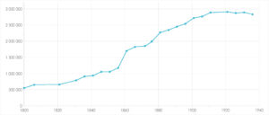
In order to reduce and define the corpus, our choice drifted towards the city of Paris. It is necessary to evoke some elements of context. From 1910 to 1937, at least 2.8 million people lived in Paris. From 1870 to 1914 ; the population had increased from 1.8 to almost 2.9 million. In total, over this period of just 40 years, Paris experienced a growth of 2.7 million inhabitants.
Saint-André-des-Arts Square – 6th borough (arrondissement) of Paris
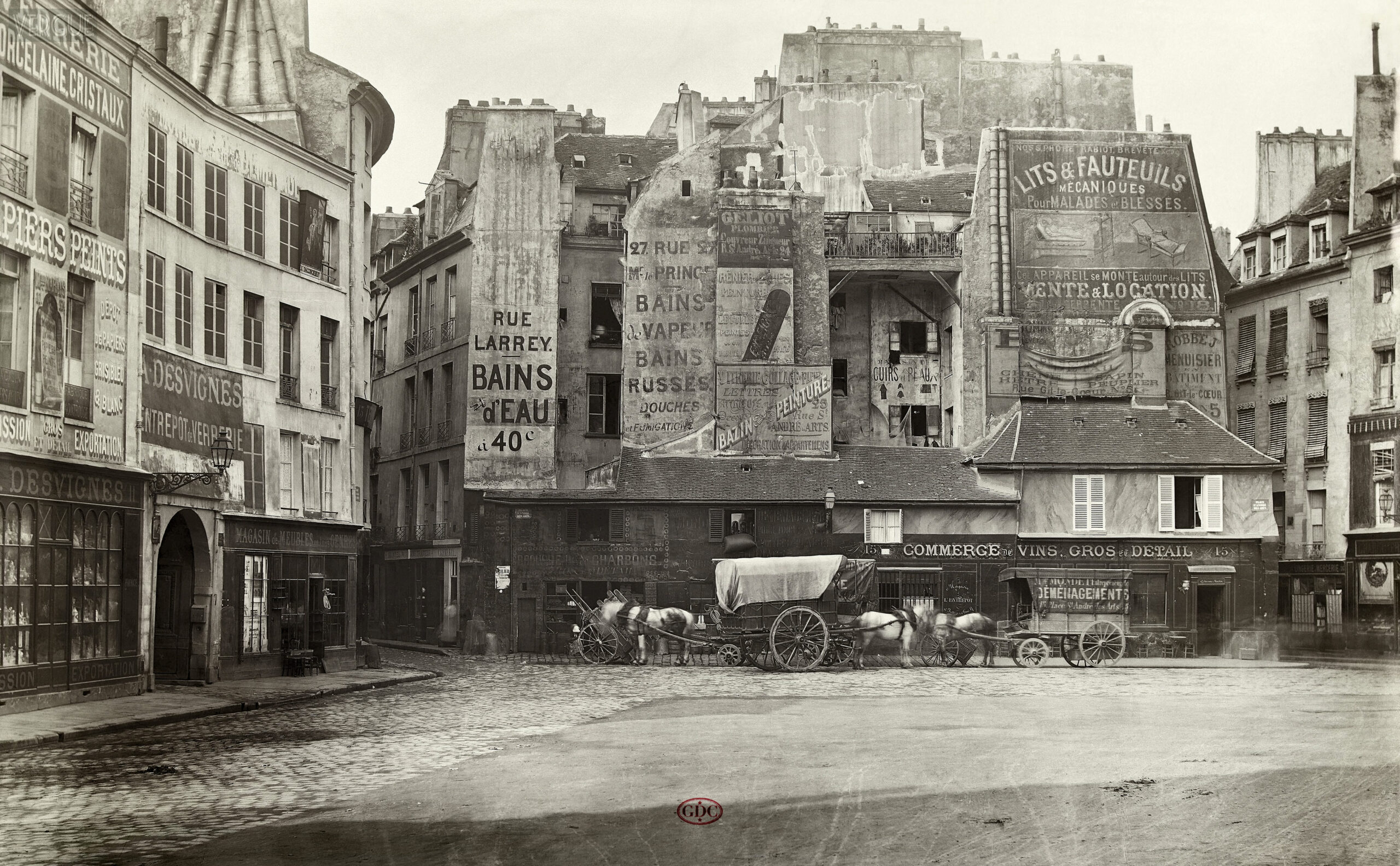

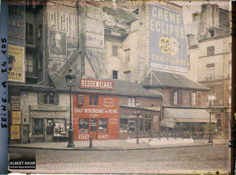
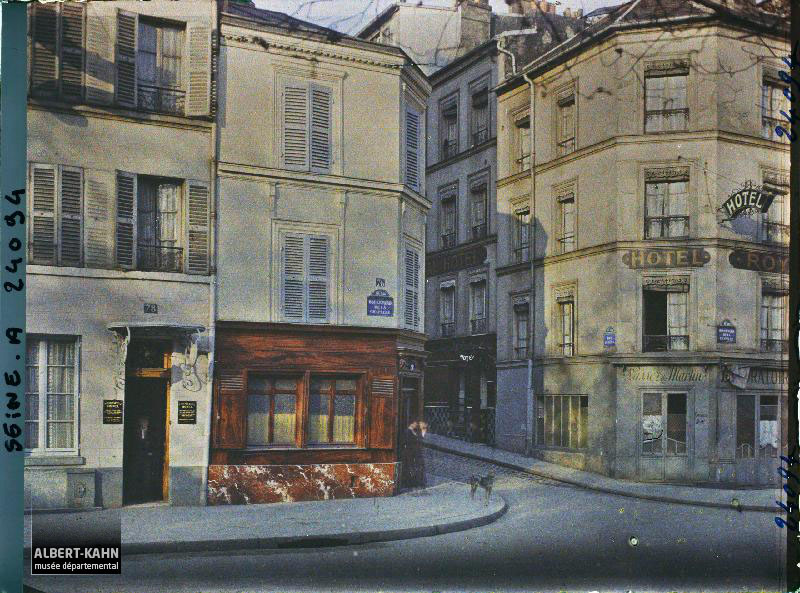
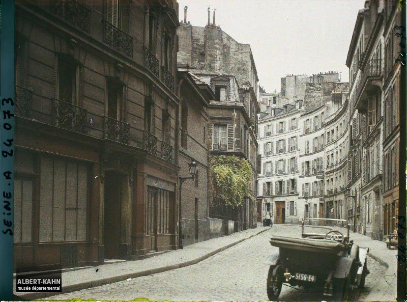
The city of Paris therefore became the field of my study. It is inseparable from photography, from the works of Louis Daguerre to those of Eugène Atget and Charles Marville’s. The plurality of urbanistic representations, particularly through the photographic medium, can be understood as a testimony of the past. Here is an example of the Place Saint-André-des-Arts, photographed at three different moments in time and showing very few urban changes.
Typology
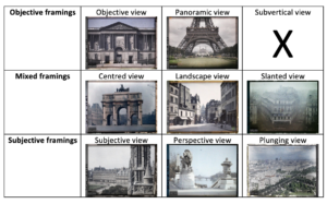
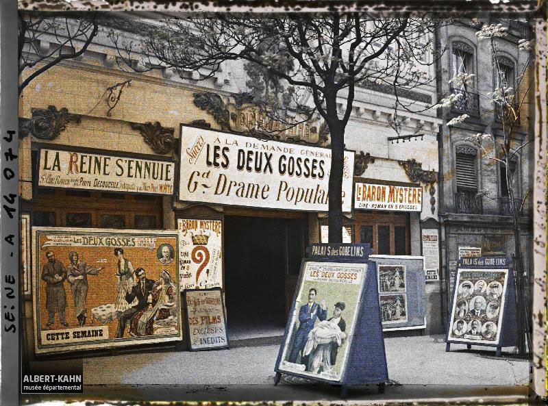
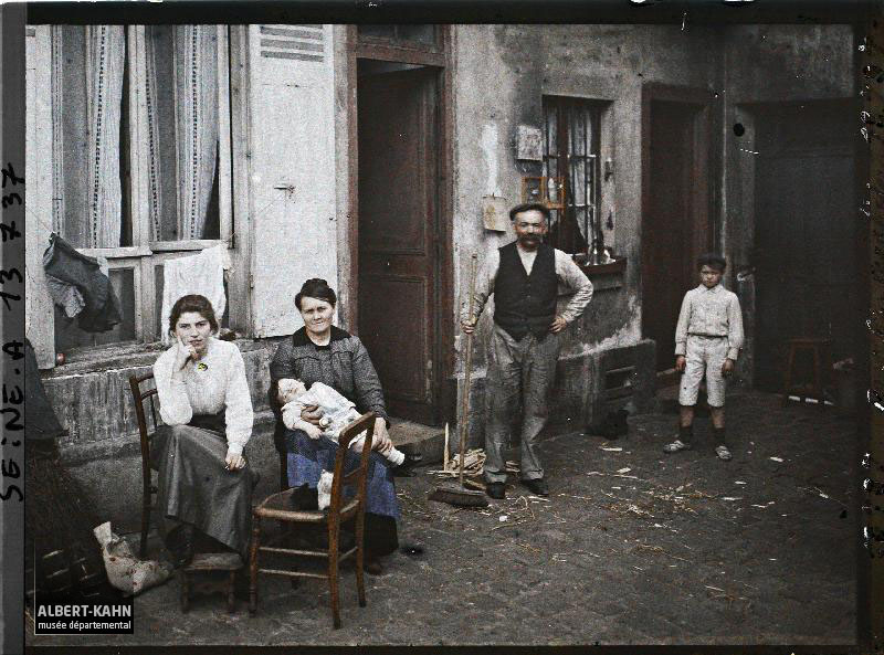
Having defined this Parisian sample, it was thus possible for us to treat this fund with analytical tools, both quantitative and cartographic. We have tried to establish a typology of the Paris Fund, in addition to having identified some themes, all while trying to reconstruct the context of creation, mixing in particular directives of the former geographer and chief scientist, freedom of action of the photographers and propaganda. The Parisian Archives of the planet are mainly composed of urban views, which is why this typology omits some rare photographs of people. In addition to these constraints, those associated with the purchase, the creation and maintenance define a non-exhaustive vision of Paris.
Example of data and its metadatas
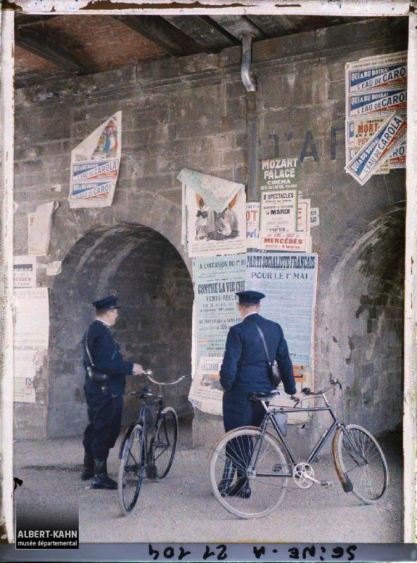
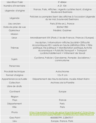
Back In 2016, the Albert-Kahn museum enabled members of the public to access its online catalogue of digital data, comprising a wise selection of autochromes. Therefore, we took a special interest in this process, where information (metadata) could be directly ascribed to the digitized image (data). Hence, in a recent project of dissemination in open data, it was possible to access all the information from the Archives of the planet available to the Albert-Kahn Museum. In total, over 65 000 photographs are referenced and accessible and their datasets are downloadable.
URL : https://opendata.hauts-de-seine.fr/explore/dataset/archives-de-la-planete/
Share of Parisian autochromes carried out per year (1910-1937)
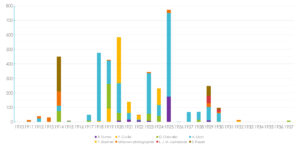
Here is quite a dense diagram showing us the share of Parisian autochromes carried out per year. We can observe some peaks in autochrome production, namely in 1914, in 1920 and in 1925. Auguste Léon, the first photographer to have been recruited by Albert Kahn, produced almost over half of the Parisian photographs.
Comparison of geographical coordinates of Paris’ 6th borough before and after their refinement
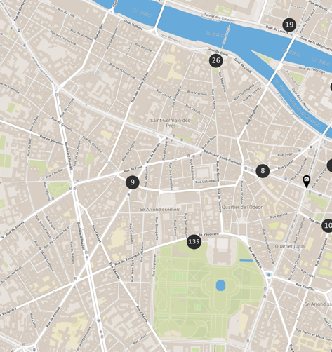
To better visualize the photographs and their geographical location, each of the 4,302 photographs composing the « Fonds Paris » has been mapped to analyze the Parisian Archives of the planet through point projections. Here we played an active role in refining data, including cartography. The museum Albert-Kahn did a data refinement with the test corpus of autochromes of the sixth borough. It was during an internship at the museum that I was able to help by carrying this work throughout the city. Thus, we got much more accurate results.
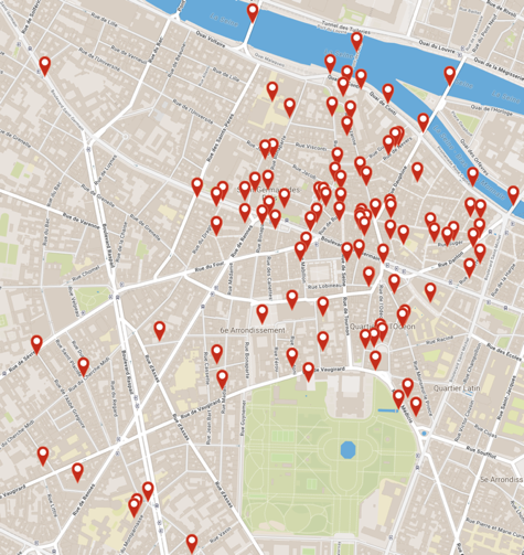
Location of Parisian shots by year from 1910 to 1937 (QGIS)
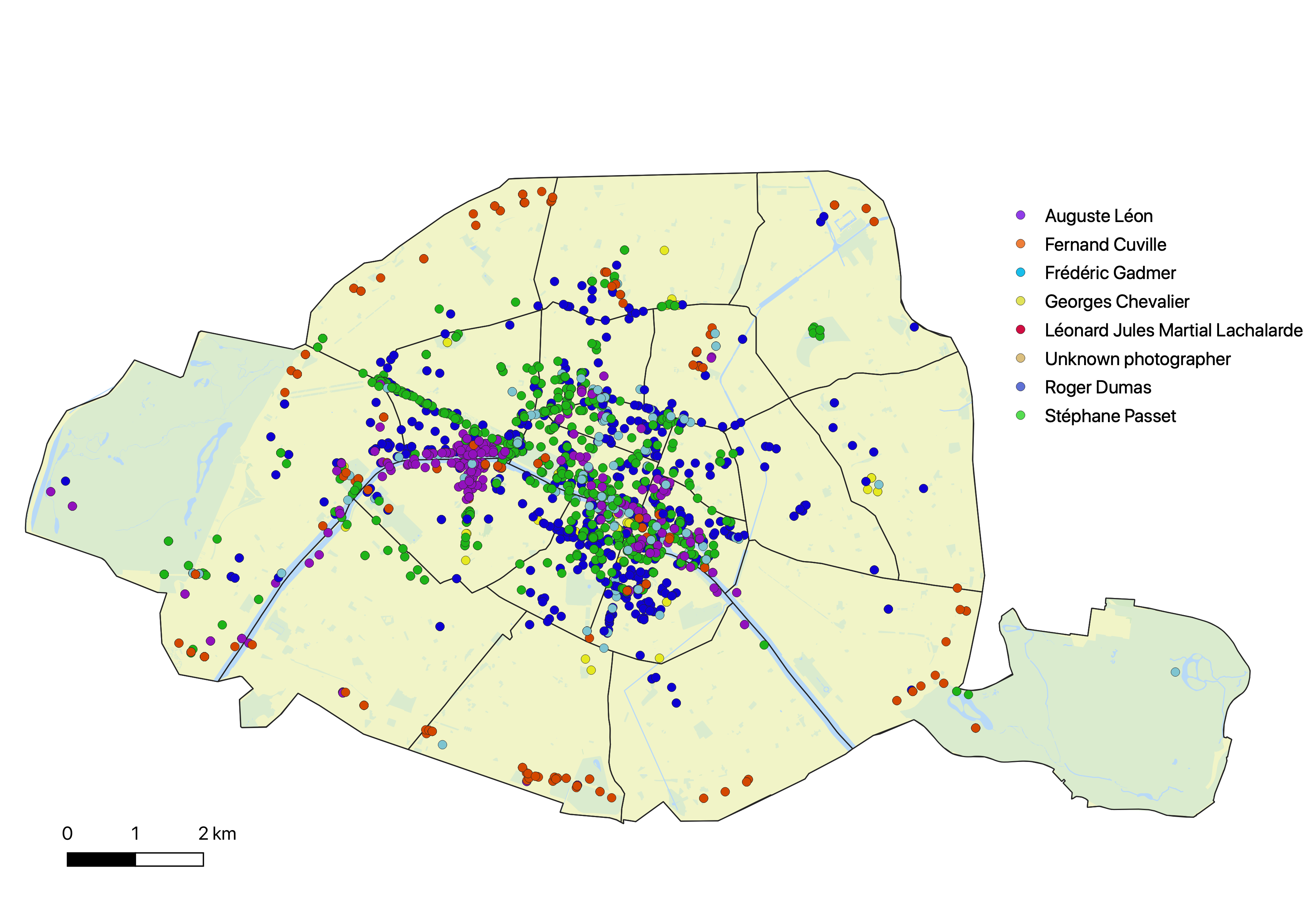
Digital cartography offers a modular overview that can be used in research as well as in cultural mediation. I will not have time to dwell on the nature of some shots, but I can give you an essential element to understand the Paris fund. These 4,302 photographs show a city in full urban transformation. The most convincing element is the contrast between the photographs of the historical and patrimonial center of Paris, and the urbanization works at work at the same time, especially at the gates of the city. The exhaustive projection proposed here can be modulated in a software of GIS, here QGIS, in order to realize fixed cartographies useful to the understanding of the Paris fund.
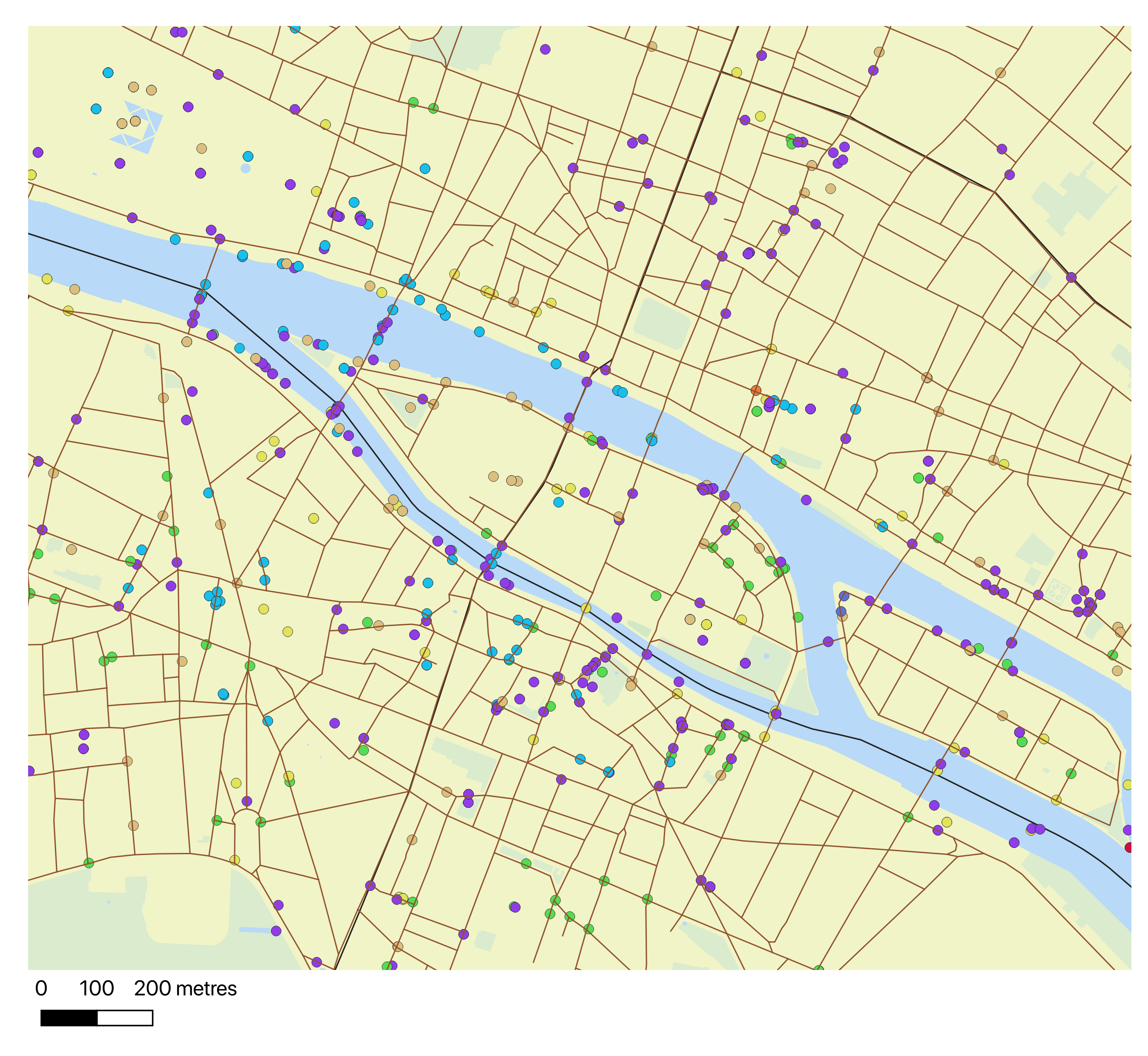
Location of Paris shots by year slots, 1910-1937 (QGIS)
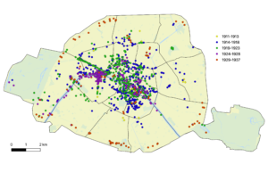
Here, we used the dates parameter, assembled by group of years, to try and make the vast amount of location shots understandable . Here, for example, the Esplanade des Invalides, which is part of the right bank of the 8th borrough, is very visible. The multiple purple dots are related to an event: namely that of the International Exhibition of Modern Decorative and Industrial Arts in 1925. By using a wide array of numerical tools, it is now possible to apprehend photographs through the use of their metadata.
Louvre autochromes
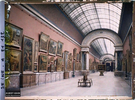
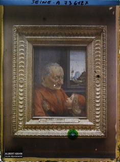
Beyond these comprehensive projections, we have also conducted some very focused studies. Here, we chose to focus on autochromes taken at the Louvre. The Louvre’s indoors have been the most photographed in the whole of Paris. There are just over a hundred photographs taken inside the museum in 1920 and 1921. Moreover, these Autochrome were among the most shown by Albert Kahn to his guests during private screenings.
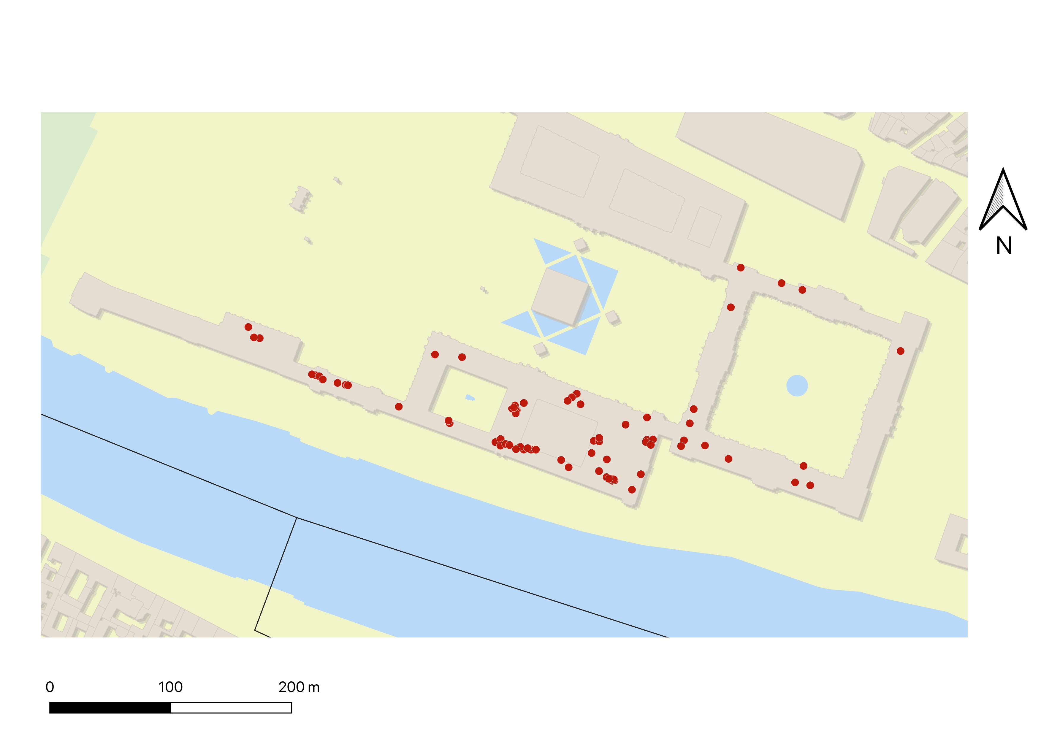
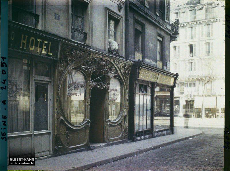
Autochromes of Frédéric Gadmer’s brothel façades
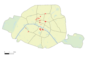
In a completely different register, the theme of the façades of brothels photographed by Frédéric Gadmer caught our attention. We do not know the motivation of such shots, probably for health and safety or to better monitor the business prostitution in Paris. This series of photographs is one of the best documented in Paris. It is also a social and architectural testimony endemic to an increasingly documented environment. As this web adaptation shows, exporting maps makes them compatible from one medium to another. (Here, the QGIS2Web extension converts our map to make it accessible on the internet.)
Geomatic Platform (EHESS), Omeka S, Screenshot of Heat Map Page
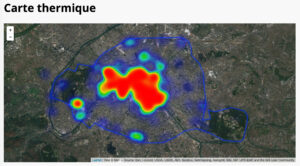
http://psig.huma-num.fr/omeka-s/s/adlp-paris
Finally, beyond QGIS, we have been able to create several dynamic maps. The geomatics platform of the EHESS had suggested we use Omeka S to perform many tests on an external platform. It is a digital library reconstituted in parallel with the original Open Data platform. The interface is flexible, and web maps can increase the treatment of the Paris fund. Here you can see a documented projection of points and a heatmap reporting the frequency of the shots.
The 1930s ended Albert Kahn’s project and the Autochrome process. The fate of the first was sealed by the crisis of 1929, while the Autochrome quickly became obsolete, the flexible support having replaced the glass plate. Remains then this testimony of a meeting between the manufacturers Lumiere and the sponsor Kahn.
Autochromes in China (Archives of the Planet) by Stéphane Passet
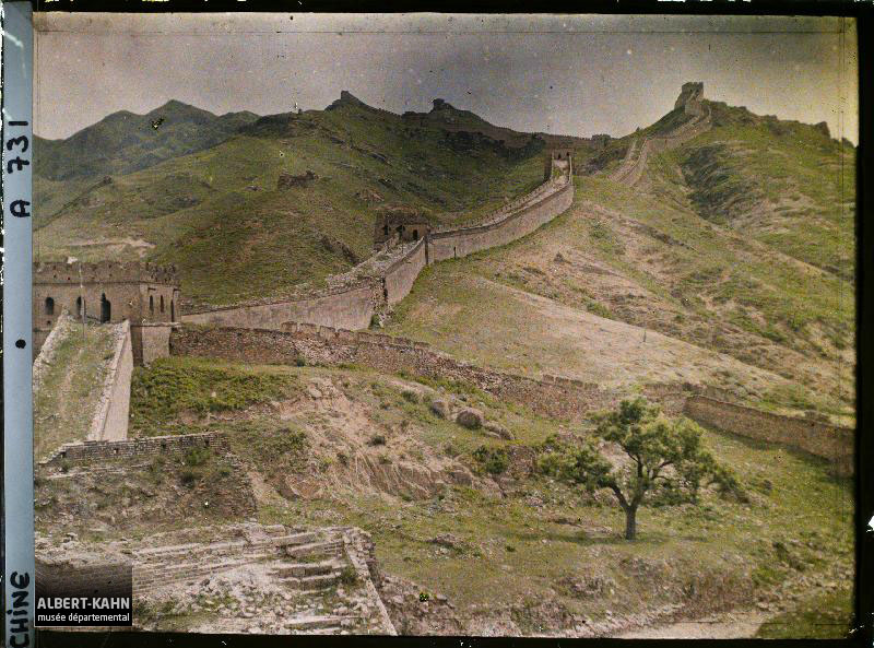
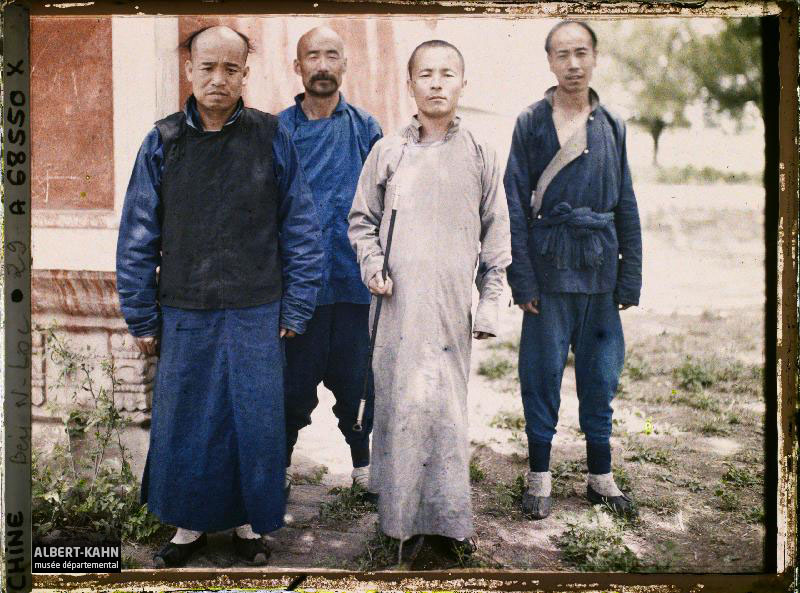
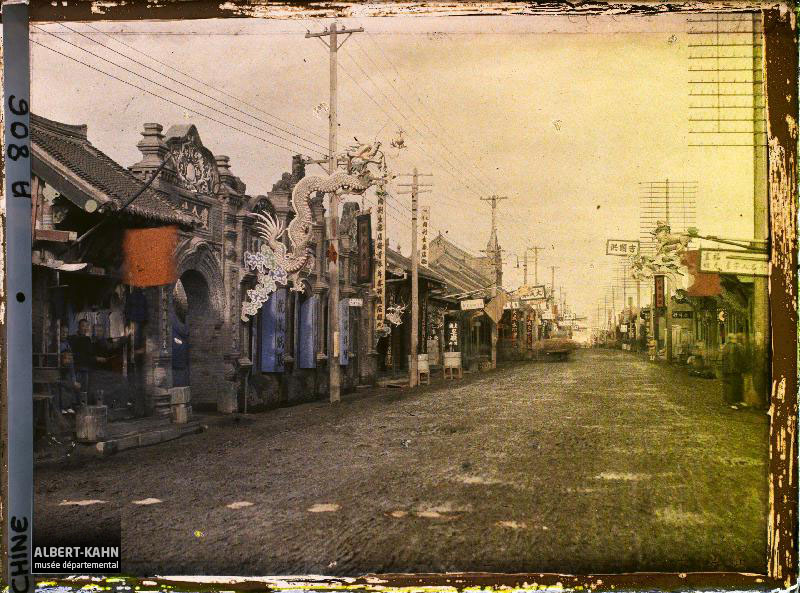
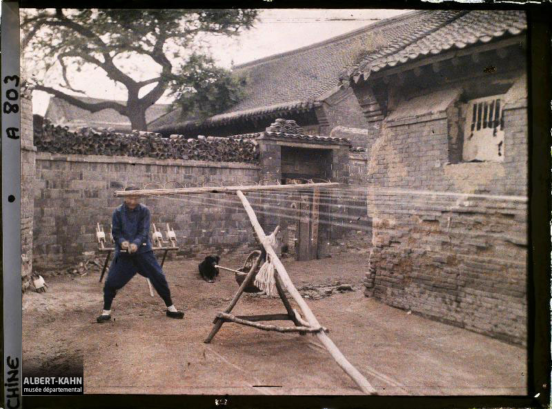
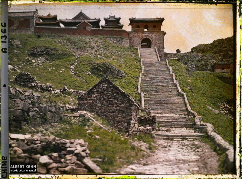
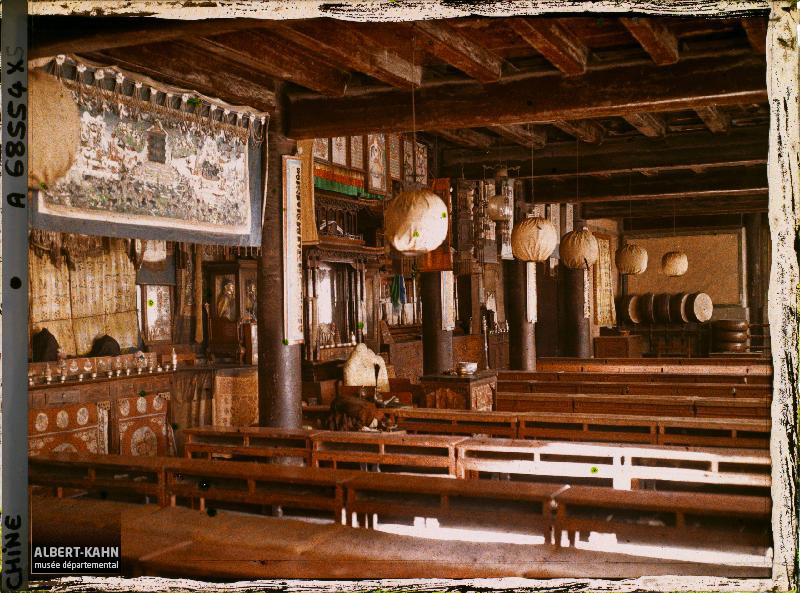
In this presentation, organized as part of the international dialogue, I wanted to show you some photographs taken outside of Paris, and therefore, outside of my area of research. As you can see, here are six photographs taken in China through several missions. There are between 700 and 800 photographs taken in China. These snapshots are referenced in a two-volume catalog that museum staff will render accessible. Amongst some of the autochromes taken in China, I must also mention the portraits of Chinese personalities as taken in the house of Albert Kahn at large processions. The guests then attended a session of projection plates autochromes and those who wished could have their portrait taken in color.
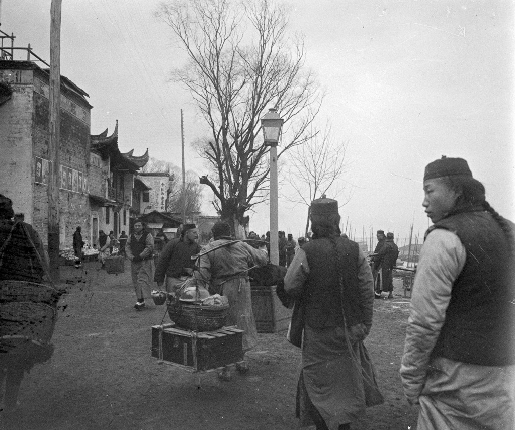
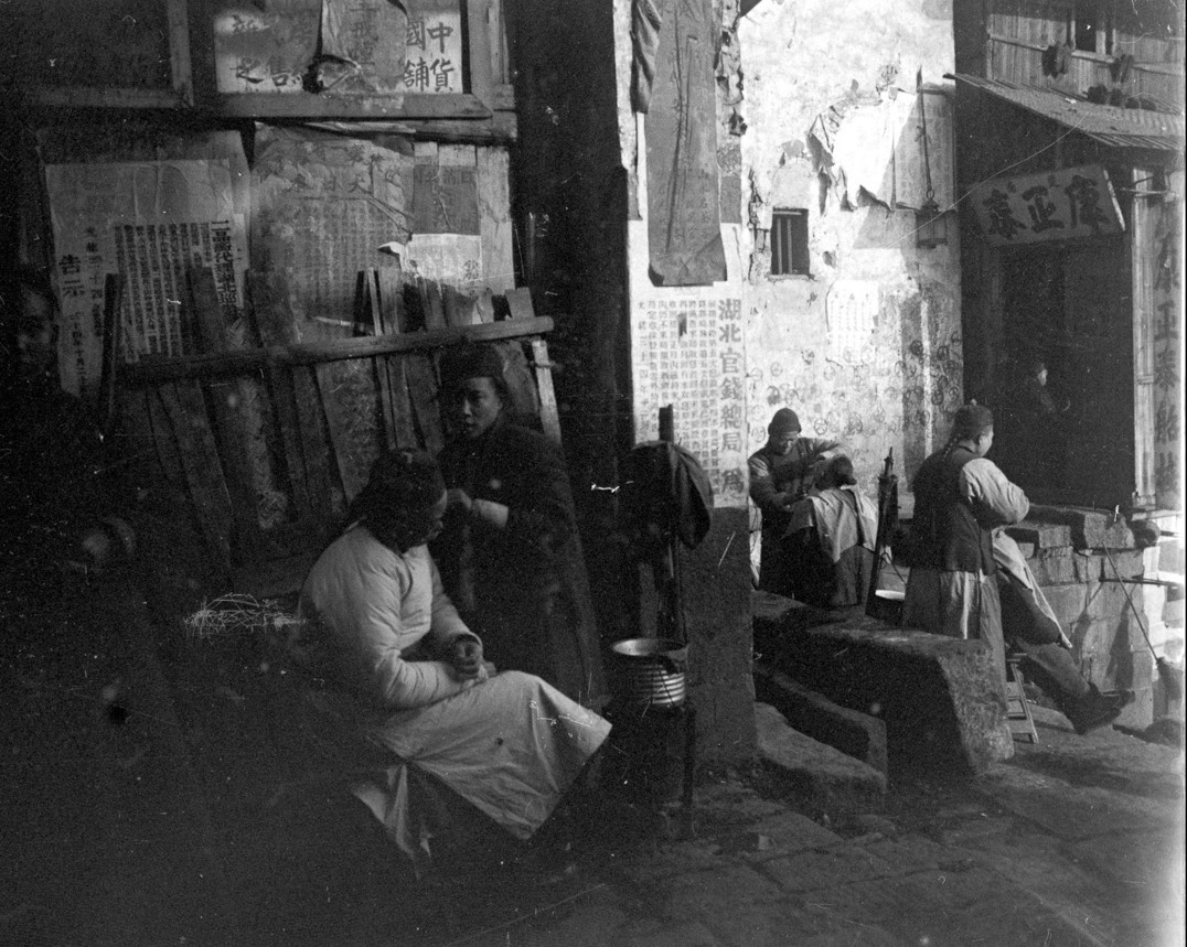
Unfortunately, there are no photographs of Wǔhàn in color. However, before the Archives of the Planet project took shape, some black and white stereoscopic photographs were made in 1909 in Hankou, an urban entity now integrated into Wǔhàn City. These photographs are part of another collection, entitled “Travels Around the World”, that were created between 1908 and 1909 and directly inspired the wish to establish the Archives of the Planet , dear to Albert Kahn.
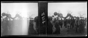
We can find a precious plaque marking the Chinese New Year as celebrated in Hankou. Here is a complete stereoscopic plate. To put the archives of the planet under a new light, digital humanities have shown that research work could also be suitable for cultural mediation work. The dataset of Parisian photographs has the benefit of being reusable. Thus, it will be used and displayed through an exhibition project featured at the Albert-Kahn museum next year.
Merci pour votre attention
Thank you for listening
感謝諸位的時間
Ajouts juin 2022 :
– Archives de la planète, fonds Paris (4 302 enregistrements) : OpenData Hauts-de-Seine
– Archives de la planète, fonds complet (65083 enregistrements) : OpenData Hauts-de-Seine
– Archives de la planète, films (21 enregistrements) : OpenData Hauts-de-Seine
– Cité de l’Architecture et du patrimoine : Exposition Paris 1910-1937. Promenades dans les collections Albert-Kahn (du 16 septembre 2020 au 5 juillet 2021)
Les Grands Boulevards, Paris, 27 octobre 1919, opérateur Lucien Le Saint (Inv. AI 122562)
Alexandre Wauthier